

Hiking Near Wildwood
You do not need a big hiking plan to spend time on the trails around Bowen. There are short walks close to Snug Cove, longer routes through the forest, and Mount Gardner if you want to make a full day of it.
Pick the one that fits your day.
Dorman Point works well when you want a short walk without giving up half the day.
The trail starts near Snug Cove and is about 2.5 km round trip, with roughly 105 metres of elevation gain. Most people can complete it in around an hour.
There are a couple of steeper sections, but it is still one of the more approachable hikes on Bowen. The viewpoint looks out over Howe Sound.
This one makes sense on an arrival day, before the ferry home, or anytime you just want to get outside for an hour.
Good for:
A short hike, first-time visitors, or an easy addition to a day around Snug Cove.
Dorman Point
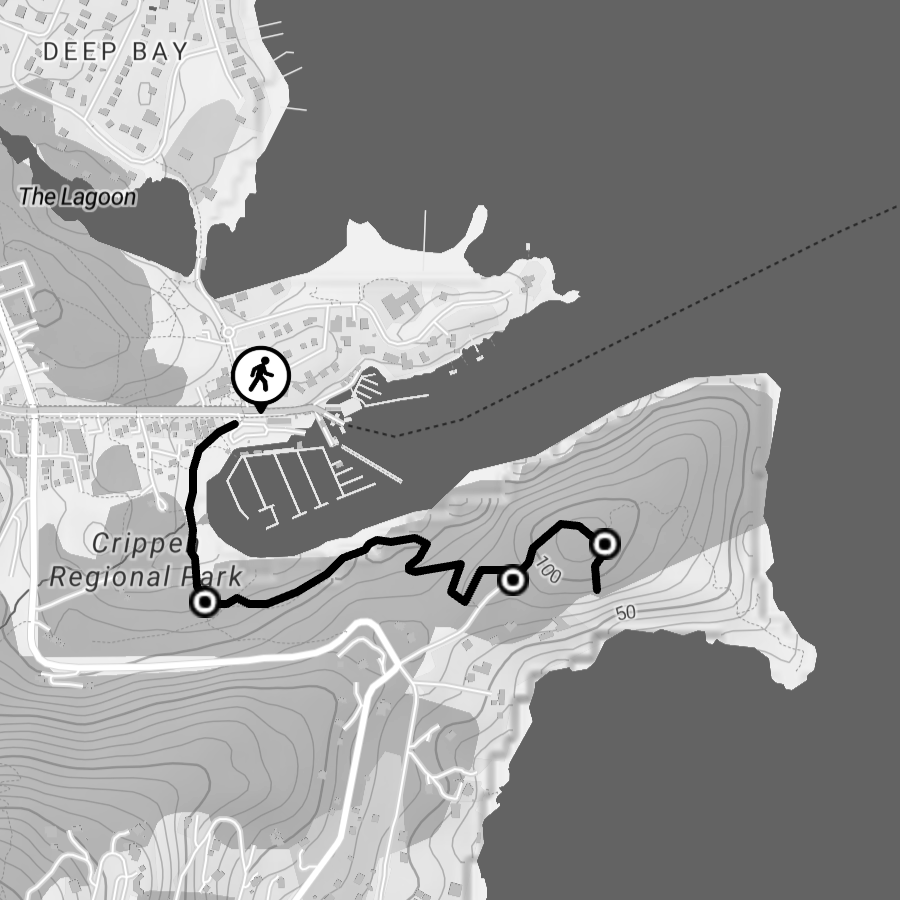
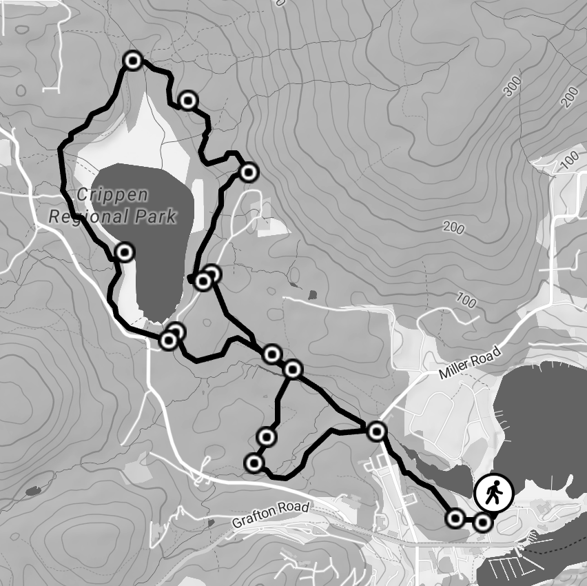
Killarney Lake gives you more time in the forest without turning the day into a climb.
The full loop is about 9 km and generally takes around two hours, although pace varies. The route stays relatively low in elevation and passes through forest, wetlands and the lake itself.
There are still a few ups and downs along the way, so it is more than a flat walk around a lake.
Bring decent shoes and give yourself time.
Good for:
A longer walk, a quieter morning or afternoon, and anyone who wants more trail without tackling Mount Gardner.
killarney lake
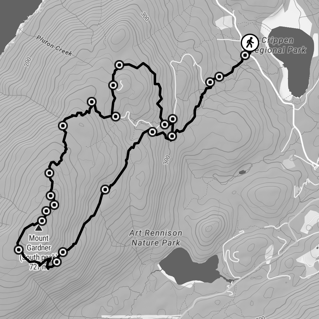
Mount Gardner Hike is different.
If you want the hike to be the main part of the day, this is the one. The full route can reach about 17 km, with roughly 719 metres of elevation gain. Vancouver Trails estimates around seven hours for the full route.
Parts of the climb are steep. Some routes toward the north peak include rope-assisted sections, and trail junctions can be confusing if you are unfamiliar with the mountain. Recent hikers have also reported that navigation deserves more attention than the official “intermediate” rating might suggest.
Do not treat it like a casual walk. Start with enough daylight, carry water, use a proper trail map or GPS route, and check conditions before heading up.
The reward is the view across Howe Sound, the Sunshine Coast and toward Vancouver.
Good for:
Experienced hikers who want a full day outside.
Mount Gardner
Which hike should you choose?
If you want something short, go to Dorman Point.
If you want a couple of hours in the forest, choose Killarney Lake.
If hiking is the plan for the day, look at Mount Gardner.
You do not need to fit more than one into the same day.
Do you need a car to get to the beaches?
No. Dorman Point and Killarney Lake can both be reached from the Snug Cove area on foot, although Killarney Lake adds more walking before and after the main loop.
A vehicle gives you more flexibility, particularly if you want to reach different trailheads around the island.
Getting to the initial part of the Mount Gardner trail is best done by car.
Even the easier trails are still coastal BC trails.
Bring comfortable shoes, water, and a layer if the weather looks uncertain.
For Mount Gardner, treat it as a proper hike rather than something you decide to do halfway through the afternoon.
Download your route before you leave if you are relying on your phone.
What should you bring?
-
Dorman Point is one of the shorter and more accessible options near Snug Cove. The trail is about 2.5 km round trip and usually takes around an hour.
-
The full route is about 9 km, with an estimated walking time of around two hours. Actual time depends on pace and stops.
-
Trail guides often rate Mount Gardner as intermediate, but it is considerably more involved than the shorter Bowen trails. The route includes sustained climbing, steep terrain, and some route-finding.
-
Yes. Dorman Point is close to the ferry terminal, and trails through Crippen Regional Park connect the Snug Cove area toward Killarney Lake.
Frequently asked questions
Then come back
You do not have to make a full itinerary out of it.
Walk for an hour. Spend half a day by the lake. Climb the mountain.
Then come back to Wildwood.